
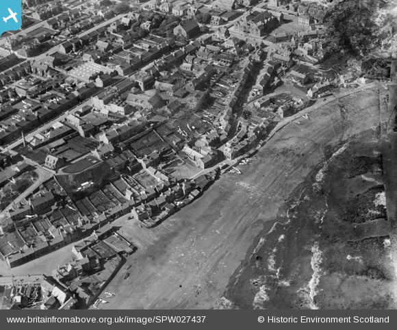
SPW027437 SCOTLAND (1929). Buckhaven, general view, showing Randolph Street and West High Street. An oblique aerial photograph taken facing north.
© Copyright OpenStreetMap contributors and licensed by the OpenStreetMap Foundation. 2025. Cartography is licensed as CC BY-SA.
Details
| Title | [SPW027437] Buckhaven, general view, showing Randolph Street and West High Street. An oblique aerial photograph taken facing north. |
| Reference | SPW027437 |
| Date | 1929 |
| Link | NRHE Collection item 1259366 |
| Place name | |
| Parish | WEMYSS |
| District | KIRKCALDY |
| Country | SCOTLAND |
| Easting / Northing | 335891, 698060 |
| Longitude / Latitude | -3.0326013037664, 56.170944431363 |
| National Grid Reference | NT359981 |
Pins

fifer |
Sunday 21st of October 2012 03:52:53 PM |