
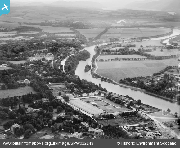
SPW022143 SCOTLAND (1928). Inverness, general view, showing Bellfield Park and Ness Islands. An oblique aerial photograph taken facing south-west.
© Copyright OpenStreetMap contributors and licensed by the OpenStreetMap Foundation. 2025. Cartography is licensed as CC BY-SA.
Details
| Title | [SPW022143] Inverness, general view, showing Bellfield Park and Ness Islands. An oblique aerial photograph taken facing south-west. |
| Reference | SPW022143 |
| Date | 1928 |
| Link | NRHE Collection item 1256512 |
| Place name | |
| Parish | INVERNESS AND BONA |
| District | INVERNESS |
| Country | SCOTLAND |
| Easting / Northing | 266449, 843903 |
| Longitude / Latitude | -4.226796987987, 57.465929617887 |
| National Grid Reference | NH664439 |
Pins

SteveAUS |
Monday 2nd of July 2012 06:59:54 AM |