
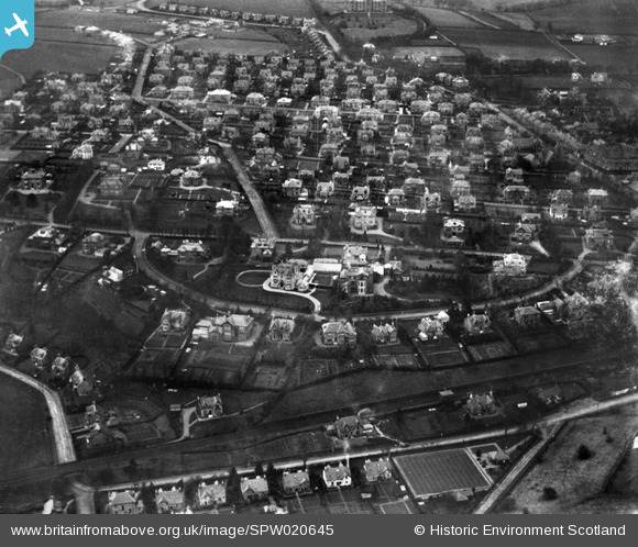
SPW020645 SCOTLAND (1928). Bearsden, general view, showing Ledcameroch Crescent , Ledcameroch Road and Whitehill Road. An oblique aerial photograph taken facing north.
© Copyright OpenStreetMap contributors and licensed by the OpenStreetMap Foundation. 2025. Cartography is licensed as CC BY-SA.
Details
| Title | [SPW020645] Bearsden, general view, showing Ledcameroch Crescent , Ledcameroch Road and Whitehill Road. An oblique aerial photograph taken facing north. |
| Reference | SPW020645 |
| Date | 1928 |
| Link | Canmore Collection item 1256403 |
| Place name | |
| Parish | NEW KILPATRICK (EAST DUNBARTONSHIRE) |
| District | BEARSDEN AND MILNGAVIE |
| Country | SCOTLAND |
| Easting / Northing | 254082, 671766 |
| Longitude / Latitude | -4.335092768208, 55.916853320876 |
| National Grid Reference | NS541718 |
Pins
 slowcoach |
Saturday 7th of July 2012 01:30:09 AM | |
wrong first time - St Peter's is further north-west. Schaw Home, as others have noted |
slowcoach |
Thursday 19th of July 2012 12:58:02 PM |
slowcoach |
Saturday 7th of July 2012 01:15:50 AM | |
slowcoach |
Saturday 7th of July 2012 01:15:06 AM | |
slowcoach |
Saturday 7th of July 2012 01:13:10 AM | |
slowcoach |
Saturday 7th of July 2012 01:10:22 AM |
User Comment Contributions
Dear all, That's great; we've reviewed your comments and thanks to your help we can update the catalogue. I have used modern aerial photography, and a digitised copy of the 3rd edition of the Ordnance Survey, and Google Street view to verify the location. The revised record will appear here in due course. Brian Wilkinson Britain from Above Activity Officer |
Brian Wilkinson |
Wednesday 29th of August 2012 02:37:55 PM |
This is a view of Bearsden, looking north. The railway line is in the foreground with Ledcameroch Road and Whitehill Road in the centreground |
Robin Downie |
Saturday 4th of August 2012 03:57:12 PM |
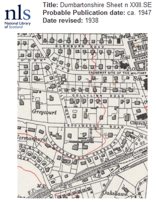 I concur with earlier comments and attach an OS map rotated to about the right angle. |
ewnmcg |
Sunday 15th of July 2012 07:25:33 PM |
Photo of Bearsden shows the junction of Station Road and Pendicle Road on lower right, beside the bowling green. In the distance is the Schaw Home. Bearsden Cross is just out of the photo, halfway up the right side, and Drymen Road runs north from there, toward the top left of the photo. In the centre are the large houses of Thorn Road, Ledcameroch, etc |
mmkv |
Sunday 8th of July 2012 02:32:43 PM |