
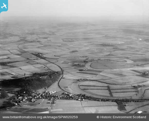
SPW020259 SCOTLAND (1928). River Forth and Abbey Craig, Stirling. An oblique aerial photograph taken facing east.
© Copyright OpenStreetMap contributors and licensed by the OpenStreetMap Foundation. 2026. Cartography is licensed as CC BY-SA.
Details
| Title | [SPW020259] River Forth and Abbey Craig, Stirling. An oblique aerial photograph taken facing east. |
| Reference | SPW020259 |
| Date | 1928 |
| Link | NRHE Collection item 1256665 |
| Place name | |
| Parish | ST NINIANS |
| District | STIRLING |
| Country | SCOTLAND |
| Easting / Northing | 282300, 694100 |
| Longitude / Latitude | -3.8936286409916, 56.125161608462 |
| National Grid Reference | NS823941 |
Pins
 Test Pin Nadia |

Nadia Test |
Monday 16th of November 2026 09:34:18 AM |
| Polmaise colliery (pits nos. 3 & 4) |

Andy A |
Monday 6th of January 2014 11:28:45 AM |
| Railway swing bridge across the Forth at Alloa |
Andy A |
Monday 6th of January 2014 11:27:36 AM |
| Manor Powis colliery |
Andy A |
Monday 6th of January 2014 11:27:02 AM |
| RNAD Bandeath - Royal Navy Armaments Depot |
Andy A |
Monday 6th of January 2014 11:25:38 AM |
| Causewayhead Railway Station |
David Hendry |
Saturday 4th of May 2013 02:51:09 PM |
| Cambuskenneth |
Xabier Cid |
Monday 9th of July 2012 12:42:45 AM |
| Railway Stirling-Alloa, then closed, then reopened in 2010. |
Xabier Cid |
Monday 9th of July 2012 12:41:54 AM |
| William Wallace Monument |
Xabier Cid |
Monday 9th of July 2012 12:40:44 AM |
| Causewayhead |
Xabier Cid |
Monday 9th of July 2012 12:40:09 AM |
User Comment Contributions
Grampian Engineering works shown in the picture. They used to make aeroplanes on this site! |
Chris |
Wednesday 27th of June 2012 12:31:37 PM |