
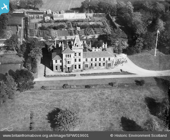
SPW019601 SCOTLAND (1927). Keil School, Helenslee Road, Dumbarton. An oblique aerial photograph taken facing north.
© Copyright OpenStreetMap contributors and licensed by the OpenStreetMap Foundation. 2025. Cartography is licensed as CC BY-SA.
Details
| Title | [SPW019601] Keil School, Helenslee Road, Dumbarton. An oblique aerial photograph taken facing north. |
| Reference | SPW019601 |
| Date | 1927 |
| Link | NRHE Collection item 1256163 |
| Place name | |
| Parish | CARDROSS (WEST DUMBARTONSHIRE) |
| District | DUMBARTON |
| Country | SCOTLAND |
| Easting / Northing | 238655, 675067 |
| Longitude / Latitude | -4.5836712750507, 55.941560836168 |
| National Grid Reference | NS387751 |
Pins
Be the first to add a comment to this image!