
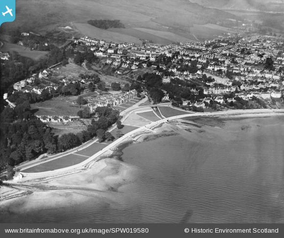
SPW019580 SCOTLAND (1927). Dunoon, general view, showing West Bay. An oblique aerial photograph taken facing north.
© Copyright OpenStreetMap contributors and licensed by the OpenStreetMap Foundation. 2026. Cartography is licensed as CC BY-SA.
Details
| Title | [SPW019580] Dunoon, general view, showing West Bay. An oblique aerial photograph taken facing north. |
| Reference | SPW019580 |
| Date | 1927 |
| Link | NRHE Collection item 1256152 |
| Place name | |
| Parish | DUNOON AND KILMUN |
| District | ARGYLL AND BUTE |
| Country | SCOTLAND |
| Easting / Northing | 217000, 676100 |
| Longitude / Latitude | -4.9306607298615, 55.943077673857 |
| National Grid Reference | NS170761 |
Pins
Be the first to add a comment to this image!
User Comment Contributions
This clearly shows the area where Broomfield Drive now stands, along the bank of the burn |

Duncan |
Friday 29th of June 2012 09:56:30 PM |