
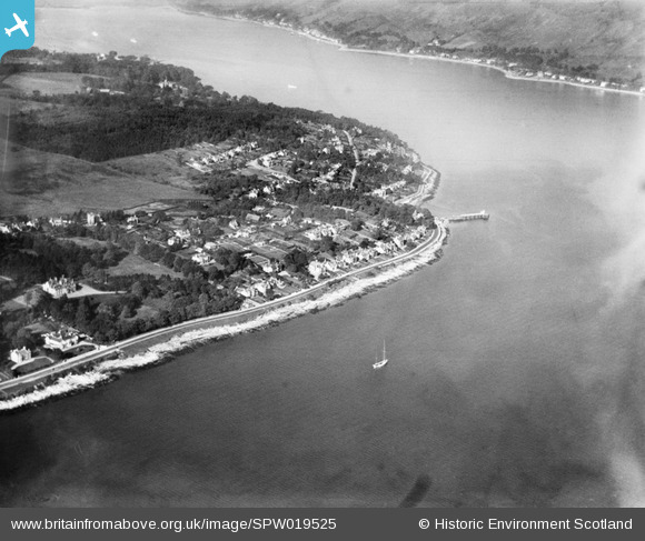
SPW019525 SCOTLAND (1927). Hunter's Quay, Dunoon, general view, showing Hunter's Quay Ferry Terminal. An oblique aerial photograph taken facing north.
© Copyright OpenStreetMap contributors and licensed by the OpenStreetMap Foundation. 2025. Cartography is licensed as CC BY-SA.
Details
| Title | [SPW019525] Hunter's Quay, Dunoon, general view, showing Hunter's Quay Ferry Terminal. An oblique aerial photograph taken facing north. |
| Reference | SPW019525 |
| Date | 1927 |
| Link | NRHE Collection item 1259181 |
| Place name | |
| Parish | DUNOON AND KILMUN |
| District | ARGYLL AND BUTE |
| Country | SCOTLAND |
| Easting / Northing | 218500, 679000 |
| Longitude / Latitude | -4.9086262721536, 55.969671556798 |
| National Grid Reference | NS185790 |
Pins
Be the first to add a comment to this image!
User Comment Contributions
The picture does not show" Hunter's Quay Ferry Terminal", it shows Hunter's Quay pier, the site of the present car ferry terminal but in 1949 this was a steamer pier like any other around the Firth of Clyde. |

Jim B |
Tuesday 20th of November 2012 10:59:00 PM |