
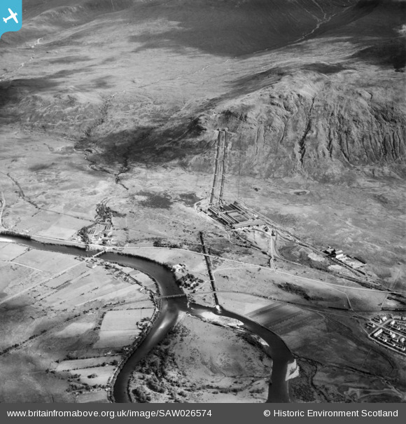
SAW026574 SCOTLAND (1949). Lochaber Hydroelectric Scheme and Aluminium Smelter, Fort William. An oblique aerial photograph taken facing east.
© Copyright OpenStreetMap contributors and licensed by the OpenStreetMap Foundation. 2026. Cartography is licensed as CC BY-SA.
Details
| Title | [SAW026574] Lochaber Hydroelectric Scheme and Aluminium Smelter, Fort William. An oblique aerial photograph taken facing east. |
| Reference | SAW026574 |
| Date | 1949 |
| Link | NRHE Collection item 1269401 |
| Place name | |
| Parish | KILMALLIE |
| District | LOCHABER |
| Country | SCOTLAND |
| Easting / Northing | 212733, 775147 |
| Longitude / Latitude | -5.0696117278101, 56.830142161835 |
| National Grid Reference | NN127751 |
Pins

JMB |
Wednesday 14th of June 2023 09:10:24 AM | |
|
JMB |
Wednesday 14th of June 2023 09:09:16 AM | |

Les H |
Monday 16th of May 2016 10:48:35 PM | |
|
Les H |
Monday 16th of May 2016 10:46:28 PM | |
I think the 'Soldiers' Bridge' footbridge was built after 1949 so not visible on this image. |
JMB |
Wednesday 14th of June 2023 08:55:29 AM |
|
Les H |
Monday 16th of May 2016 10:38:17 PM | |
|
Andy A |
Friday 5th of February 2016 10:36:10 PM | |
Usually known locally as "The Puggy LIne" |
JMB |
Wednesday 14th of June 2023 09:13:29 AM |