
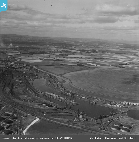
SAW018839 SCOTLAND (1948). Grangemouth, general view, showing Grange Dock and Skinflats. An oblique aerial photograph taken facing north-west. This image has been produced from a print.
© Copyright OpenStreetMap contributors and licensed by the OpenStreetMap Foundation. 2026. Cartography is licensed as CC BY-SA.
Details
| Title | [SAW018839] Grangemouth, general view, showing Grange Dock and Skinflats. An oblique aerial photograph taken facing north-west. This image has been produced from a print. |
| Reference | SAW018839 |
| Date | 1948 |
| Link | NRHE Collection item 1314881 |
| Place name | |
| Parish | GRANGEMOUTH |
| District | FALKIRK |
| Country | SCOTLAND |
| Easting / Northing | 291440, 683170 |
| Longitude / Latitude | -3.7422227203133, 56.029159992707 |
| National Grid Reference | NS914832 |
Pins
Be the first to add a comment to this image!