
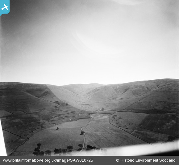
SAW010725 SCOTLAND (1947). River South Esk and Huntly Cot Hills, Moorfoot Hills. An oblique aerial photograph taken facing south.
© Copyright OpenStreetMap contributors and licensed by the OpenStreetMap Foundation. 2025. Cartography is licensed as CC BY-SA.
Details
| Title | [SAW010725] River South Esk and Huntly Cot Hills, Moorfoot Hills. An oblique aerial photograph taken facing south. |
| Reference | SAW010725 |
| Date | 1947 |
| Link | NRHE Collection item 1268717 |
| Place name | |
| Parish | TEMPLE |
| District | MIDLOTHIAN |
| Country | SCOTLAND |
| Easting / Northing | 329766, 651247 |
| Longitude / Latitude | -3.1190339759472, 55.749509777792 |
| National Grid Reference | NT298512 |
Pins
Be the first to add a comment to this image!