
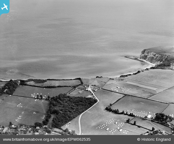
EPW062535 ENGLAND (1939). Army campsites around Whitecliff Bay Country Club, Bembridge, from the north-west, 1939
© Copyright OpenStreetMap contributors and licensed by the OpenStreetMap Foundation. 2026. Cartography is licensed as CC BY-SA.
Details
| Title | [EPW062535] Army campsites around Whitecliff Bay Country Club, Bembridge, from the north-west, 1939 |
| Reference | EPW062535 |
| Date | 11-August-1939 |
| Link | |
| Place name | BEMBRIDGE |
| Parish | BEMBRIDGE |
| District | |
| Country | ENGLAND |
| Easting / Northing | 463834, 86455 |
| Longitude / Latitude | -1.096517937851, 50.673675400599 |
| National Grid Reference | SZ638865 |
Pins

Maurice |
Thursday 5th of September 2013 08:45:05 AM | |
|
Maurice |
Thursday 5th of September 2013 08:43:34 AM |
User Comment Contributions
I agree with Maurice that this appears to be a standing camp, probably just for the summer and most likely scouts or guides but not an Army camp. Taken in August 1939 and the storm clouds or war were already in place with regular and territorial units already being mobilised. These tents would show out too well to be military and the Isle of Wight was not traditionally used by military units for training. |

flubber |
Friday 1st of November 2013 06:34:13 PM |