
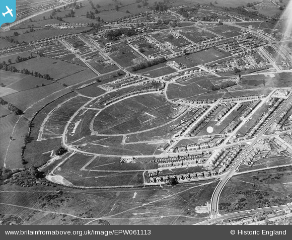
EPW061113 ENGLAND (1939). New housing estate under construction, Cheylesmore, 1939
© Copyright OpenStreetMap contributors and licensed by the OpenStreetMap Foundation. 2026. Cartography is licensed as CC BY-SA.
Details
| Title | [EPW061113] New housing estate under construction, Cheylesmore, 1939 |
| Reference | EPW061113 |
| Date | 30-May-1939 |
| Link | |
| Place name | CHEYLESMORE |
| Parish | |
| District | |
| Country | ENGLAND |
| Easting / Northing | 434217, 277096 |
| Longitude / Latitude | -1.4971410308152, 52.390438246019 |
| National Grid Reference | SP342771 |
Pins

Garland's Joke Shop |
Wednesday 13th of August 2025 04:37:46 PM | |
|
Garland's Joke Shop |
Wednesday 13th of August 2025 04:37:13 PM | |
|
Garland's Joke Shop |
Wednesday 13th of August 2025 04:37:00 PM | |
|
Garland's Joke Shop |
Wednesday 13th of August 2025 04:35:29 PM | |
|
fridge |
Tuesday 27th of August 2019 12:08:10 PM | |
|
Alex |
Wednesday 6th of May 2015 02:34:15 PM | |
|
tim |
Friday 25th of July 2014 06:38:14 PM | |
|
tim |
Friday 25th of July 2014 06:35:12 PM | |
|
tim |
Friday 25th of July 2014 06:30:57 PM | |
|
tim |
Friday 25th of July 2014 06:27:21 PM | |
|
tim |
Friday 25th of July 2014 06:24:51 PM |