
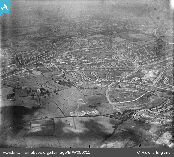
EPW059311 ENGLAND (1938). The Kingstanding Housing Estate under construction, Queslett, from the north-west, 1938
© Copyright OpenStreetMap contributors and licensed by the OpenStreetMap Foundation. 2026. Cartography is licensed as CC BY-SA.
Details
| Title | [EPW059311] The Kingstanding Housing Estate under construction, Queslett, from the north-west, 1938 |
| Reference | EPW059311 |
| Date | 8-September-1938 |
| Link | |
| Place name | QUESLETT |
| Parish | |
| District | |
| Country | ENGLAND |
| Easting / Northing | 407045, 294228 |
| Longitude / Latitude | -1.8961013158118, 52.545496404897 |
| National Grid Reference | SP070942 |
Pins

Andy Mabbett |
Saturday 27th of February 2021 02:23:15 PM | |
|
Andy Mabbett |
Saturday 27th of February 2021 02:22:31 PM | |
|
Andy Mabbett |
Saturday 27th of February 2021 02:21:34 PM | |
|
Andy Mabbett |
Saturday 27th of February 2021 02:20:48 PM | |
|
Andy Mabbett |
Saturday 27th of February 2021 02:15:32 PM | |
|
Andy Mabbett |
Saturday 27th of February 2021 02:14:17 PM | |
|
Andy Mabbett |
Saturday 27th of February 2021 02:12:48 PM | |
|
Andy Mabbett |
Saturday 27th of February 2021 02:12:23 PM | |
|
Andy Mabbett |
Saturday 27th of February 2021 02:10:41 PM | |

John S |
Wednesday 23rd of November 2016 08:45:15 PM | |
|
John S |
Wednesday 23rd of November 2016 08:42:33 PM | |
|
John S |
Monday 6th of October 2014 01:13:41 PM | |
|
dadge |
Monday 9th of June 2014 09:57:55 PM | |
|
dadge |
Monday 9th of June 2014 09:57:31 PM |