
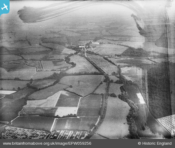
EPW059256 ENGLAND (1938). The Rother Light Railway Line adjacent to Fowlbrook Wood and surrounding countryside, Salehurst, from the west, 1938. This image has been produced from a damaged negative.
© Copyright OpenStreetMap contributors and licensed by the OpenStreetMap Foundation. 2026. Cartography is licensed as CC BY-SA.
Details
| Title | [EPW059256] The Rother Light Railway Line adjacent to Fowlbrook Wood and surrounding countryside, Salehurst, from the west, 1938. This image has been produced from a damaged negative. |
| Reference | EPW059256 |
| Date | 11-September-1938 |
| Link | |
| Place name | SALEHURST |
| Parish | SALEHURST AND ROBERTSBRIDGE |
| District | |
| Country | ENGLAND |
| Easting / Northing | 576234, 124038 |
| Longitude / Latitude | 0.51131282459726, 50.988183521298 |
| National Grid Reference | TQ762240 |
Pins

Railway Routes |
Saturday 27th of February 2021 04:37:26 PM | |
|
Railway Routes |
Saturday 27th of February 2021 04:37:04 PM | |
|
Railway Routes |
Saturday 27th of February 2021 04:36:46 PM | |
|
Railway Routes |
Saturday 27th of February 2021 04:33:58 PM | |
|
Railway Routes |
Saturday 27th of February 2021 04:33:21 PM |