
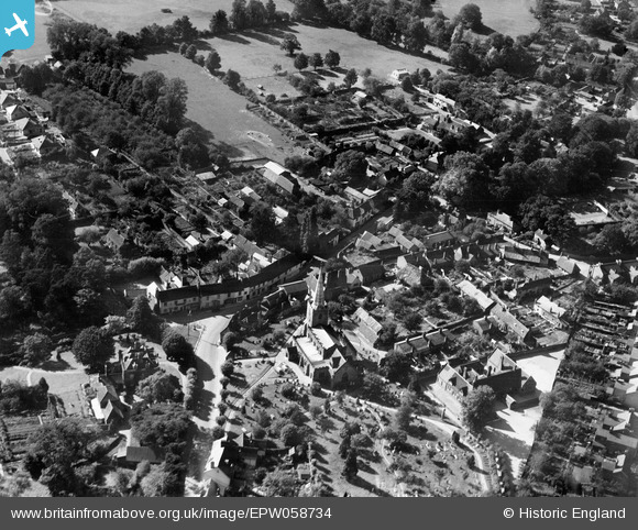
EPW058734 ENGLAND (1938). St Mary's Church and the village, Chelmsford, 1938
© Copyright OpenStreetMap contributors and licensed by the OpenStreetMap Foundation. 2026. Cartography is licensed as CC BY-SA.
Details
| Title | [EPW058734] St Mary's Church and the village, Chelmsford, 1938 |
| Reference | EPW058734 |
| Date | 23-August-1938 |
| Link | |
| Place name | GREAT BADDOW |
| Parish | GREAT BADDOW |
| District | |
| Country | ENGLAND |
| Easting / Northing | 572863, 204878 |
| Longitude / Latitude | 0.50260697935238, 51.715495317829 |
| National Grid Reference | TL729049 |
Pins
 PUMP HILL PUMP HILL |

Doug |
Tuesday 7th of October 2014 09:13:22 PM |
| THE READING ROOM |
Doug |
Tuesday 7th of October 2014 09:12:15 PM |
| NEW ROAD |
Doug |
Tuesday 7th of October 2014 08:56:24 PM |
| BELL STREET |
Doug |
Tuesday 7th of October 2014 08:55:29 PM |
| CHURCHYARD WALK |
Doug |
Friday 14th of February 2014 09:15:58 PM |
| GREAT BADDOW INFANT AND JUNIOR SCHOOL |
Doug |
Friday 14th of February 2014 09:13:27 PM |
| THE VICARAGE ROOM |
Doug |
Friday 14th of February 2014 09:12:35 PM |
| THE VICARAGE |
Doug |
Friday 14th of February 2014 09:11:39 PM |
| THE WHITE HORSE PH |
Doug |
Friday 14th of February 2014 09:09:21 PM |
| THE CHASE |
Doug |
Friday 14th of February 2014 09:07:02 PM |
| VICARAGE LANE, CHELMSFORD |
Ian |
Saturday 25th of January 2014 01:20:51 PM |
| GALLEYWOOD RD, CHELMSFORD |
Ian |
Saturday 25th of January 2014 01:19:56 PM |
| PUMP CAUSEWAY, CHELMSFORD |
Ian |
Saturday 25th of January 2014 01:18:04 PM |
I BEG TO DIFFER, I LIVED IN GREAT BADDOW FROM 1938 TO 1954. PUMP HILL IS ONE ROAD AND THE CAUSEWAY IS ANOTHER. PUMP HILL RUNS FROM BELL STREET TO CHURCH STREET (SOUTHEND ROAD) AND THE CAUSEWAY RUNS FROM TOP OF PUMP HILL TO MALDON ROAD. AS A MATTER OF INTEREST PUMP HILL WAS ALSO KNOWN AS SLUTS HILL ALSO WELL STREET AND AT SOMETIME DUCKING STOOL LANE |
Doug |
Tuesday 7th of October 2014 09:02:09 PM |
| HIGH STREET, GREAT BADDOW, CHELMSFORD |
Ian |
Saturday 25th of January 2014 01:14:54 PM |
| CHURCH STREET, CHELMSFORD |
Ian |
Saturday 25th of January 2014 01:13:55 PM |