
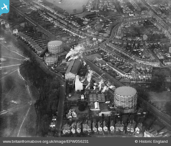
EPW056231 ENGLAND (1937). Teddington Gasworks on Sandy Lane, Hampton Wick, 1937
© Copyright OpenStreetMap contributors and licensed by the OpenStreetMap Foundation. 2026. Cartography is licensed as CC BY-SA.
Details
| Title | [EPW056231] Teddington Gasworks on Sandy Lane, Hampton Wick, 1937 |
| Reference | EPW056231 |
| Date | 14-December-1937 |
| Link | |
| Place name | HAMPTON WICK |
| Parish | |
| District | |
| Country | ENGLAND |
| Easting / Northing | 516964, 170061 |
| Longitude / Latitude | -0.31778798584159, 51.416990441527 |
| National Grid Reference | TQ170701 |
Pins

percommode |
Friday 28th of November 2014 09:00:09 PM | |
|
Pip |
Thursday 2nd of January 2014 12:15:24 PM | |
|
percommode |
Sunday 25th of August 2013 08:14:25 PM |