
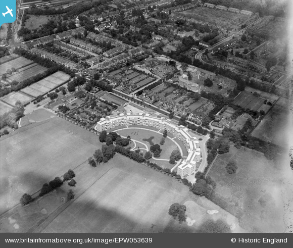
EPW053639 ENGLAND (1937). Fairacres, Roehampton, 1937
© Copyright OpenStreetMap contributors and licensed by the OpenStreetMap Foundation. 2026. Cartography is licensed as CC BY-SA.
Details
| Title | [EPW053639] Fairacres, Roehampton, 1937 |
| Reference | EPW053639 |
| Date | 12-June-1937 |
| Link | |
| Place name | ROEHAMPTON |
| Parish | |
| District | |
| Country | ENGLAND |
| Easting / Northing | 522065, 175088 |
| Longitude / Latitude | -0.24272653308227, 51.461099417692 |
| National Grid Reference | TQ221751 |
Pins

Pink Sparkle Girl |
Tuesday 22nd of April 2025 08:55:22 PM |