
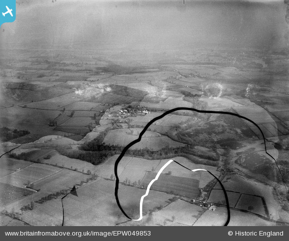
EPW049853 ENGLAND (1936). The Walls hillfort, Walls Coppice and surrounding countryside, Chesterton, from the south, 1936. This image has been produced from a damaged negative.
© Copyright OpenStreetMap contributors and licensed by the OpenStreetMap Foundation. 2026. Cartography is licensed as CC BY-SA.
Details
| Title | [EPW049853] The Walls hillfort, Walls Coppice and surrounding countryside, Chesterton, from the south, 1936. This image has been produced from a damaged negative. |
| Reference | EPW049853 |
| Date | April-1936 |
| Link | |
| Place name | CHESTERTON |
| Parish | WORFIELD |
| District | |
| Country | ENGLAND |
| Easting / Northing | 378629, 296585 |
| Longitude / Latitude | -2.3153261204337, 52.566313683009 |
| National Grid Reference | SO786966 |
Pins
Be the first to add a comment to this image!