
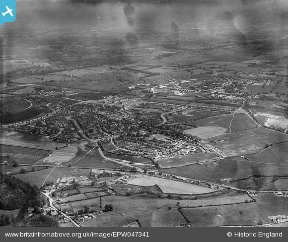
EPW047341 ENGLAND (1935). The town, Welwyn Garden City, from the west, 1935
© Copyright OpenStreetMap contributors and licensed by the OpenStreetMap Foundation. 2026. Cartography is licensed as CC BY-SA.
Details
| Title | [EPW047341] The town, Welwyn Garden City, from the west, 1935 |
| Reference | EPW047341 |
| Date | May-1935 |
| Link | |
| Place name | WELWYN GARDEN CITY |
| Parish | HATFIELD |
| District | |
| Country | ENGLAND |
| Easting / Northing | 522302, 212155 |
| Longitude / Latitude | -0.22636834798281, 51.794207564156 |
| National Grid Reference | TL223122 |
Pins

Wolfie |
Thursday 22nd of February 2024 08:04:34 PM | |
|
Wolfie |
Thursday 22nd of February 2024 08:04:16 PM | |

JMW |
Thursday 23rd of March 2017 09:24:55 PM | |
|
JMW |
Thursday 23rd of March 2017 09:24:16 PM | |
|
JMW |
Thursday 23rd of March 2017 09:23:30 PM |