
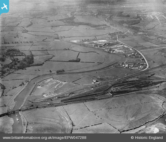
EPW047288 ENGLAND (1935). The River Trent Navigation and adjacent industry, Colwick, from the north-east, 1935
© Copyright OpenStreetMap contributors and licensed by the OpenStreetMap Foundation. 2025. Cartography is licensed as CC BY-SA.
Details
| Title | [EPW047288] The River Trent Navigation and adjacent industry, Colwick, from the north-east, 1935 |
| Reference | EPW047288 |
| Date | May-1935 |
| Link | |
| Place name | COLWICK |
| Parish | STOKE BARDOLPH |
| District | |
| Country | ENGLAND |
| Easting / Northing | 463537, 340169 |
| Longitude / Latitude | -1.0541304461577, 52.954815417725 |
| National Grid Reference | SK635402 |
Pins

MPD73 |
Monday 26th of May 2025 06:45:11 AM | |
|
MPD73 |
Monday 26th of May 2025 06:44:22 AM | |
|
MPD73 |
Monday 26th of May 2025 06:41:12 AM | |
|
MPD73 |
Monday 26th of May 2025 06:39:14 AM | |
|
MPD73 |
Monday 26th of May 2025 06:37:43 AM | |
|
MPD73 |
Monday 26th of May 2025 06:33:49 AM | |
|
MPD73 |
Monday 26th of May 2025 06:31:51 AM | |
|
MPD73 |
Monday 26th of May 2025 06:30:32 AM | |
|
MPD73 |
Monday 26th of May 2025 06:27:57 AM | |
|
MPD73 |
Monday 26th of May 2025 06:25:56 AM | |
|
MPD73 |
Monday 26th of May 2025 06:24:45 AM | |
|
MPD73 |
Monday 26th of May 2025 06:22:06 AM | |
|
MPD73 |
Monday 26th of May 2025 06:19:39 AM | |
|
MPD73 |
Monday 26th of May 2025 06:12:02 AM | |
|
MPD73 |
Monday 26th of May 2025 06:08:33 AM | |
|
MPD73 |
Monday 26th of May 2025 06:06:37 AM | |
|
John Wass |
Sunday 27th of September 2015 08:00:12 PM |