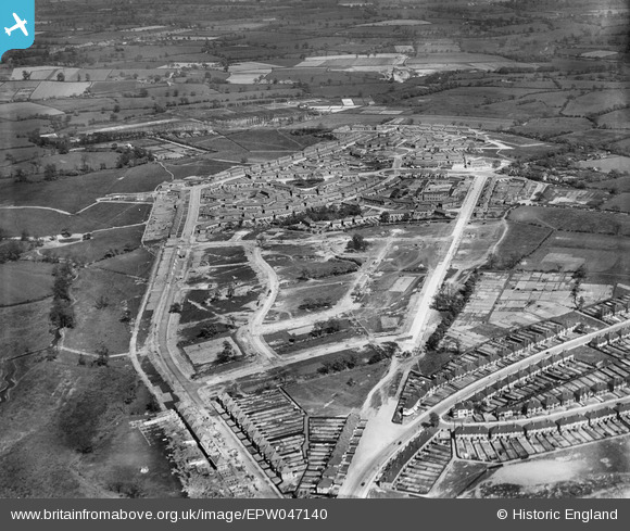
EPW047140 ENGLAND (1935). The residential area surrounding Audley Road and Wyndhurst Road under construction, Stechford, 1935
© Copyright OpenStreetMap contributors and licensed by the OpenStreetMap Foundation. 2026. Cartography is licensed as CC BY-SA.
Details
| Title | [EPW047140] The residential area surrounding Audley Road and Wyndhurst Road under construction, Stechford, 1935 |
| Reference | EPW047140 |
| Date | May-1935 |
| Link | |
| Place name | STECHFORD |
| Parish | |
| District | |
| Country | ENGLAND |
| Easting / Northing | 413705, 287929 |
| Longitude / Latitude | -1.7981407722997, 52.488735814469 |
| National Grid Reference | SP137879 |