
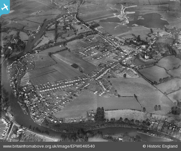
EPW046540 ENGLAND (1935). Manor Farm Estate and the village, Wraysbury, 1935
© Copyright OpenStreetMap contributors and licensed by the OpenStreetMap Foundation. 2026. Cartography is licensed as CC BY-SA.
Details
| Title | [EPW046540] Manor Farm Estate and the village, Wraysbury, 1935 |
| Reference | EPW046540 |
| Date | February-1935 |
| Link | |
| Place name | WRAYSBURY |
| Parish | WRAYSBURY |
| District | |
| Country | ENGLAND |
| Easting / Northing | 499699, 173944 |
| Longitude / Latitude | -0.5649139983388, 51.455197863639 |
| National Grid Reference | SU997739 |
Pins
 Nursery Way Nursery Way |

MP |
Saturday 11th of July 2026 12:34:28 AM |
| The Thames, Runnymede and towards Magna Carta Island |
flubber |
Tuesday 21st of May 2013 06:39:05 PM |
| Wraysbury village |
flubber |
Tuesday 21st of May 2013 06:37:21 PM |
| The Bells of Ouesley, Straight Road, Old Windsor. (Now a 'Harvester'). |
flubber |
Tuesday 21st of May 2013 06:36:01 PM |
| Ham Island |
flubber |
Tuesday 21st of May 2013 06:34:14 PM |
| Ouseley Road |
flubber |
Tuesday 21st of May 2013 06:33:15 PM |
| B376 Welley Road |
flubber |
Tuesday 21st of May 2013 06:32:48 PM |