
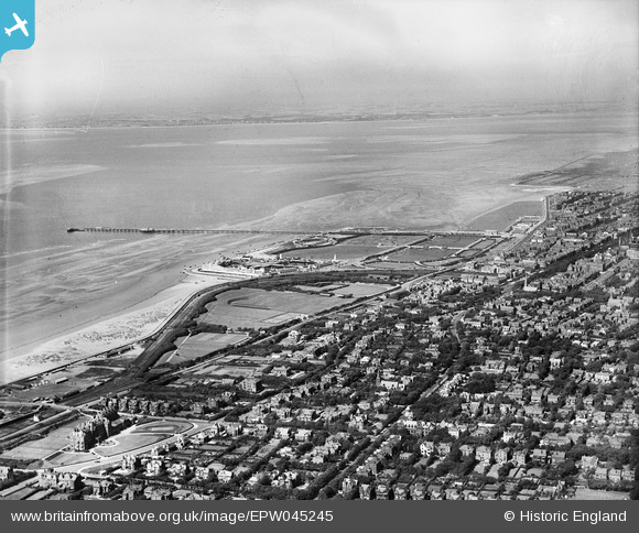
EPW045245 ENGLAND (1934). Victoria Park, the Pier and the town looking towards Lytham St Anne's, Southport, from the south, 1934
© Copyright OpenStreetMap contributors and licensed by the OpenStreetMap Foundation. 2026. Cartography is licensed as CC BY-SA.
Details
| Title | [EPW045245] Victoria Park, the Pier and the town looking towards Lytham St Anne's, Southport, from the south, 1934 |
| Reference | EPW045245 |
| Date | July-1934 |
| Link | |
| Place name | SOUTHPORT |
| Parish | |
| District | |
| Country | ENGLAND |
| Easting / Northing | 332658, 416457 |
| Longitude / Latitude | -3.0186926616576, 53.640055869045 |
| National Grid Reference | SD327165 |
Pins

John Wass |
Saturday 9th of May 2015 02:15:50 PM | |
|
wadey |
Saturday 6th of December 2014 10:31:08 PM | |
|
wadey |
Saturday 6th of December 2014 10:30:46 PM | |
|
wadey |
Saturday 6th of December 2014 10:30:17 PM | |
|
wadey |
Saturday 6th of December 2014 10:29:54 PM | |
|
Bryan |
Wednesday 27th of November 2013 07:03:12 PM |