
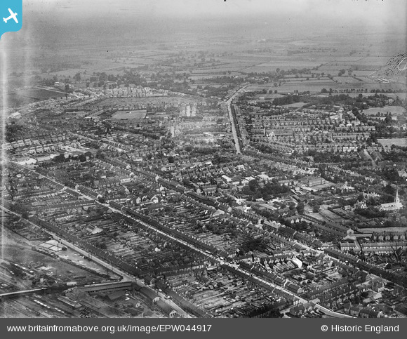
EPW044917 ENGLAND (1934). Millfield and environs, Peterborough, from the south-west, 1934
© Copyright OpenStreetMap contributors and licensed by the OpenStreetMap Foundation. 2026. Cartography is licensed as CC BY-SA.
Details
| Title | [EPW044917] Millfield and environs, Peterborough, from the south-west, 1934 |
| Reference | EPW044917 |
| Date | June-1934 |
| Link | |
| Place name | PETERBOROUGH |
| Parish | |
| District | |
| Country | ENGLAND |
| Easting / Northing | 518772, 299268 |
| Longitude / Latitude | -0.24700554986489, 52.577880596107 |
| National Grid Reference | TL188993 |
Pins

wiferiley |
Sunday 18th of July 2021 09:43:35 AM | |
|
wiferiley |
Sunday 18th of July 2021 09:42:33 AM | |
|
TheHistorySpy |
Thursday 5th of September 2013 02:49:02 PM |