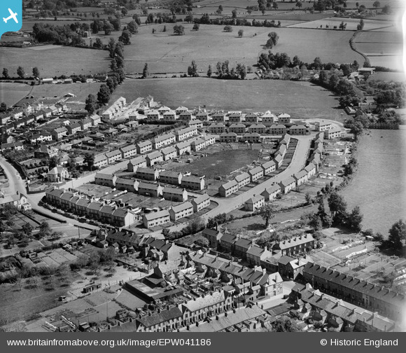
EPW041186 ENGLAND (1933). New housing at Wedlands, Lyngford, 1933
© Copyright OpenStreetMap contributors and licensed by the OpenStreetMap Foundation. 2025. Cartography is licensed as CC BY-SA.
Details
| Title | [EPW041186] New housing at Wedlands, Lyngford, 1933 |
| Reference | EPW041186 |
| Date | May-1933 |
| Link | |
| Place name | LYNGFORD |
| Parish | |
| District | |
| Country | ENGLAND |
| Easting / Northing | 323003, 126090 |
| Longitude / Latitude | -3.0980900391955, 51.028475239281 |
| National Grid Reference | ST230261 |
Pins

ANDREW BLACKMORE |
Wednesday 30th of September 2020 11:22:09 AM | |
|
Somerset Chick |
Thursday 15th of September 2016 04:47:08 PM | |

Class31 |
Sunday 17th of May 2015 11:03:47 AM | |
|
Class31 |
Sunday 17th of May 2015 11:00:37 AM | |
|
finney |
Tuesday 10th of December 2013 05:05:54 PM |