
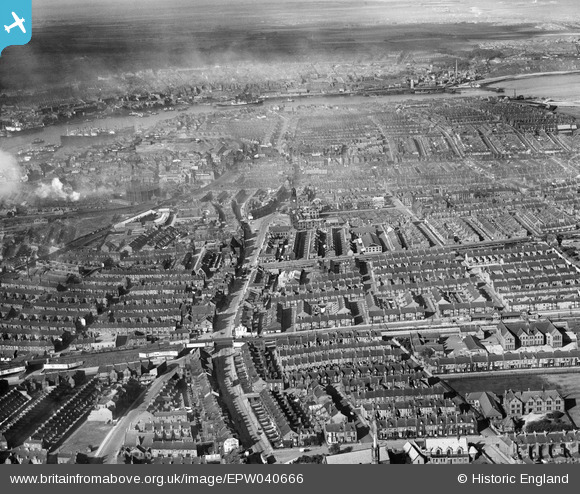
EPW040666 ENGLAND (1932). The town, South Shields, from the south, 1932
© Copyright OpenStreetMap contributors and licensed by the OpenStreetMap Foundation. 2026. Cartography is licensed as CC BY-SA.
Details
| Title | [EPW040666] The town, South Shields, from the south, 1932 |
| Reference | EPW040666 |
| Date | October-1932 |
| Link | |
| Place name | SOUTH SHIELDS |
| Parish | |
| District | |
| Country | ENGLAND |
| Easting / Northing | 436776, 566489 |
| Longitude / Latitude | -1.4251541751699, 54.991554500003 |
| National Grid Reference | NZ368665 |
Pins

N Dunn |
Saturday 4th of January 2020 10:33:06 AM | |
|
N Dunn |
Saturday 4th of January 2020 10:32:04 AM | |
|
N Dunn |
Saturday 4th of January 2020 10:29:19 AM | |
|
N Dunn |
Saturday 20th of October 2018 10:55:57 AM | |
|
N Dunn |
Saturday 20th of October 2018 10:52:55 AM | |
|
N Dunn |
Saturday 20th of October 2018 10:50:36 AM | |
|
N Dunn |
Saturday 6th of October 2018 04:20:33 PM | |
|
N Dunn |
Saturday 6th of October 2018 04:18:39 PM | |
|
N Dunn |
Monday 1st of October 2018 04:02:44 PM |