
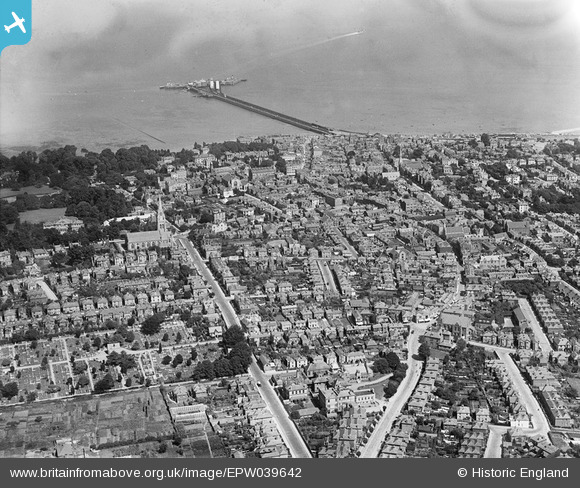
EPW039642 ENGLAND (1932). West Street, the town centre and the pier, Ryde, from the south-west, 1932
© Copyright OpenStreetMap contributors and licensed by the OpenStreetMap Foundation. 2026. Cartography is licensed as CC BY-SA.
Details
| Title | [EPW039642] West Street, the town centre and the pier, Ryde, from the south-west, 1932 |
| Reference | EPW039642 |
| Date | 12-August-1932 |
| Link | |
| Place name | RYDE |
| Parish | RYDE |
| District | |
| Country | ENGLAND |
| Easting / Northing | 458952, 92041 |
| Longitude / Latitude | -1.1647158721981, 50.724424184586 |
| National Grid Reference | SZ590920 |


