
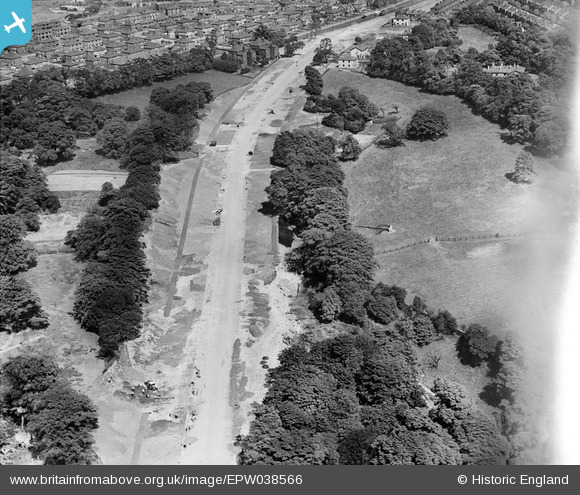
EPW038566 ENGLAND (1932). The East Lancashire Road (A580) under construction, Swinton Park, 1932. This image has been affected by flare.
© Copyright OpenStreetMap contributors and licensed by the OpenStreetMap Foundation. 2026. Cartography is licensed as CC BY-SA.
Details
| Title | [EPW038566] The East Lancashire Road (A580) under construction, Swinton Park, 1932. This image has been affected by flare. |
| Reference | EPW038566 |
| Date | June-1932 |
| Link | |
| Place name | SWINTON PARK |
| Parish | |
| District | |
| Country | ENGLAND |
| Easting / Northing | 378888, 400698 |
| Longitude / Latitude | -2.3183237168766, 53.502302806725 |
| National Grid Reference | SD789007 |
Pins

Craig stapley |
Monday 12th of February 2024 09:00:22 PM | |

Lizzie |
Monday 27th of July 2020 03:17:36 PM | |
|
Lizzie |
Monday 27th of July 2020 03:12:16 PM | |
|
Lizzie |
Monday 27th of July 2020 03:11:26 PM | |
|
Lizzie |
Monday 27th of July 2020 02:59:27 PM | |
|
howard2 |
Friday 14th of December 2012 08:13:30 PM |