
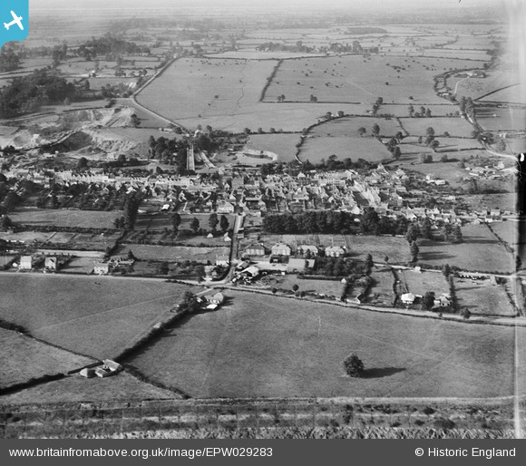
EPW029283 ENGLAND (1929). The town, Chipping Sodbury, from the south, 1929
© Copyright OpenStreetMap contributors and licensed by the OpenStreetMap Foundation. 2026. Cartography is licensed as CC BY-SA.
Details
| Title | [EPW029283] The town, Chipping Sodbury, from the south, 1929 |
| Reference | EPW029283 |
| Date | September-1929 |
| Link | |
| Place name | CHIPPING SODBURY |
| Parish | SODBURY |
| District | |
| Country | ENGLAND |
| Easting / Northing | 372867, 181772 |
| Longitude / Latitude | -2.3912206518392, 51.533721420645 |
| National Grid Reference | ST729818 |
Pins

John Llewellyn |
Thursday 13th of August 2020 01:54:48 PM | |
|
alexdanversdyer@yahoo.co.uk |
Sunday 24th of May 2015 09:00:44 PM | |
|
freestyle |
Friday 10th of April 2015 03:28:22 PM |