
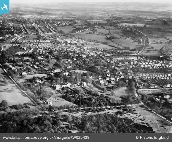
EPW025438 ENGLAND (1928). Warren Road, Albion Hill and environs, Loughton, from the south-west, 1928. This image has been produced from a copy-negative.
© Copyright OpenStreetMap contributors and licensed by the OpenStreetMap Foundation. 2026. Cartography is licensed as CC BY-SA.
Details
| Title | [EPW025438] Warren Road, Albion Hill and environs, Loughton, from the south-west, 1928. This image has been produced from a copy-negative. |
| Reference | EPW025438 |
| Date | November-1928 |
| Link | |
| Place name | LOUGHTON |
| Parish | LOUGHTON |
| District | |
| Country | ENGLAND |
| Easting / Northing | 541378, 195554 |
| Longitude / Latitude | 0.043357817574757, 51.640527035904 |
| National Grid Reference | TQ414956 |
Pins

somoody |
Tuesday 20th of May 2025 03:36:15 PM | |
|
somoody |
Tuesday 20th of May 2025 03:33:30 PM | |
|
somoody |
Tuesday 20th of May 2025 03:32:18 PM | |
|
somoody |
Tuesday 20th of May 2025 03:31:25 PM | |
|
somoody |
Tuesday 20th of May 2025 03:30:20 PM | |
|
somoody |
Tuesday 20th of May 2025 03:28:26 PM | |
|
somoody |
Tuesday 20th of May 2025 03:27:17 PM | |
|
somoody |
Tuesday 20th of May 2025 03:25:59 PM | |
|
somoody |
Tuesday 20th of May 2025 03:23:42 PM | |
|
somoody |
Tuesday 20th of May 2025 03:23:00 PM | |
|
somoody |
Tuesday 20th of May 2025 03:22:00 PM | |
|
somoody |
Tuesday 20th of May 2025 03:21:29 PM |