
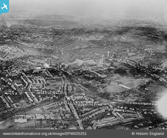
EPW025251 ENGLAND (1928). Crystal Palace Park and Crystal Palace, Penge, from the south-east, 1928. This image has been produced from a copy-negative.
© Copyright OpenStreetMap contributors and licensed by the OpenStreetMap Foundation. 2026. Cartography is licensed as CC BY-SA.
Details
| Title | [EPW025251] Crystal Palace Park and Crystal Palace, Penge, from the south-east, 1928. This image has been produced from a copy-negative. |
| Reference | EPW025251 |
| Date | 25-October-1928 |
| Link | |
| Place name | PENGE |
| Parish | |
| District | |
| Country | ENGLAND |
| Easting / Northing | 534328, 170279 |
| Longitude / Latitude | -0.068113704879529, 51.415100838036 |
| National Grid Reference | TQ343703 |
Pins

Paul Wendon |
Tuesday 16th of February 2021 10:07:44 PM | |
|
Paul Wendon |
Tuesday 16th of February 2021 10:05:51 PM | |
|
Paul Wendon |
Tuesday 16th of February 2021 10:01:22 PM | |
|
Paul Wendon |
Tuesday 16th of February 2021 09:59:03 PM | |
|
Paul Wendon |
Tuesday 16th of February 2021 09:58:38 PM | |
|
brianbeckett |
Sunday 28th of June 2020 03:42:57 PM | |
|
John W |
Saturday 11th of February 2017 03:49:10 PM | |
Impossible. The camera is looking towards the North West. |
brianbeckett |
Sunday 28th of June 2020 03:45:55 PM |
|
John Wass |
Friday 26th of June 2015 03:39:54 PM | |
|
John Wass |
Friday 26th of June 2015 03:38:30 PM | |
|
John Wass |
Friday 26th of June 2015 03:36:59 PM | |
|
John Wass |
Friday 26th of June 2015 03:35:19 PM |