
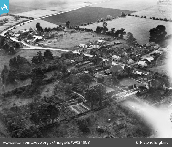
EPW024658 ENGLAND (1928). The High Street, Sutton Courtenay, 1928
© Copyright OpenStreetMap contributors and licensed by the OpenStreetMap Foundation. 2024. Cartography is licensed as CC BY-SA.
Details
| Title | [EPW024658] The High Street, Sutton Courtenay, 1928 |
| Reference | EPW024658 |
| Date | September-1928 |
| Link | |
| Place name | SUTTON COURTENAY |
| Parish | SUTTON COURTENAY |
| District | |
| Country | ENGLAND |
| Easting / Northing | 450036, 193295 |
| Longitude / Latitude | -1.2769284695435, 51.635766633843 |
| National Grid Reference | SU500933 |
Pins
Be the first to add a comment to this image!


