
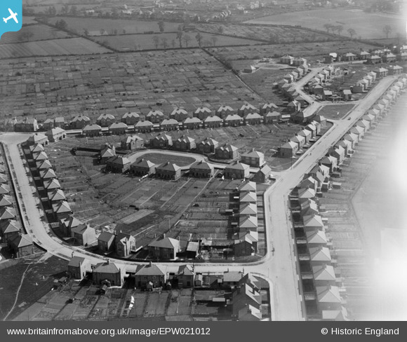
EPW021012 ENGLAND (1928). Eastlands Place, Rugby, 1928
© Copyright OpenStreetMap contributors and licensed by the OpenStreetMap Foundation. 2026. Cartography is licensed as CC BY-SA.
Details
| Title | [EPW021012] Eastlands Place, Rugby, 1928 |
| Reference | EPW021012 |
| Date | April-1928 |
| Link | |
| Place name | RUGBY |
| Parish | |
| District | |
| Country | ENGLAND |
| Easting / Northing | 451736, 275101 |
| Longitude / Latitude | -1.2400072264327, 52.37112700777 |
| National Grid Reference | SP517751 |
Pins

RichLeamington |
Friday 29th of August 2025 04:33:42 PM | |
|
Anthony Appleyard |
Wednesday 23rd of October 2013 08:59:02 AM | |
|
Anthony Appleyard |
Wednesday 23rd of October 2013 08:58:37 AM | |
|
Anthony Appleyard |
Wednesday 23rd of October 2013 08:58:11 AM | |
|
Anthony Appleyard |
Wednesday 23rd of October 2013 08:57:37 AM | |
|
Anthony Appleyard |
Wednesday 23rd of October 2013 08:57:02 AM | |
|
richardw |
Wednesday 18th of September 2013 09:33:37 AM | |
|
richardw |
Wednesday 18th of September 2013 09:31:58 AM |