
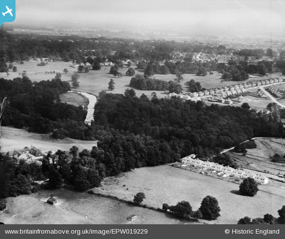
EPW019229 ENGLAND (1927). Cassiobury Park, West Watford, 1927
© Copyright OpenStreetMap contributors and licensed by the OpenStreetMap Foundation. 2026. Cartography is licensed as CC BY-SA.
Details
| Title | [EPW019229] Cassiobury Park, West Watford, 1927 |
| Reference | EPW019229 |
| Date | August-1927 |
| Link | |
| Place name | WEST WATFORD |
| Parish | |
| District | |
| Country | ENGLAND |
| Easting / Northing | 509030, 196683 |
| Longitude / Latitude | -0.42360188900999, 51.657878969626 |
| National Grid Reference | TQ090967 |
Pins

Fusty Box |
Thursday 5th of February 2015 04:11:36 PM | |

John Swain |
Monday 1st of December 2014 02:41:51 PM | |
|
John Swain |
Monday 1st of December 2014 02:40:12 PM | |
|
John Swain |
Monday 1st of December 2014 02:39:39 PM | |
|
John Swain |
Monday 1st of December 2014 02:39:03 PM | |

Class31 |
Monday 7th of October 2013 03:27:45 PM | |
|
Class31 |
Monday 7th of October 2013 03:26:37 PM | |

Mike |
Friday 27th of July 2012 02:24:44 PM |
User Comment Contributions
Looking north east. |
Class31 |
Monday 7th of October 2013 03:28:30 PM |