
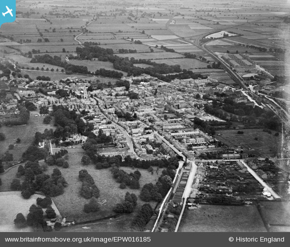
EPW016185 ENGLAND (1926). The town centre, Sleaford, from the west, 1926
© Copyright OpenStreetMap contributors and licensed by the OpenStreetMap Foundation. 2026. Cartography is licensed as CC BY-SA.
Details
| Title | [EPW016185] The town centre, Sleaford, from the west, 1926 |
| Reference | EPW016185 |
| Date | 2-July-1926 |
| Link | |
| Place name | SLEAFORD |
| Parish | SLEAFORD |
| District | |
| Country | ENGLAND |
| Easting / Northing | 506332, 345790 |
| Longitude / Latitude | -0.41541012534678, 52.998554901698 |
| National Grid Reference | TF063458 |
Pins

Kentishman |
Monday 16th of February 2026 09:08:31 PM | |
|
keefee |
Sunday 30th of July 2017 11:14:28 AM | |
|
Vauni |
Monday 22nd of April 2013 02:34:13 PM | |
|
Vauni |
Monday 22nd of April 2013 02:26:34 PM | |
|
Vauni |
Monday 22nd of April 2013 02:25:06 PM | |
|
Vauni |
Monday 22nd of April 2013 02:24:06 PM | |
Built as part of the Bass Brewing empire |
Smudger |
Tuesday 10th of December 2013 04:40:46 PM |