
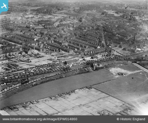
EPW014860 ENGLAND (1926). Mexborough Junction and environs, Mexborough, 1926
© Copyright OpenStreetMap contributors and licensed by the OpenStreetMap Foundation. 2026. Cartography is licensed as CC BY-SA.
Details
| Title | [EPW014860] Mexborough Junction and environs, Mexborough, 1926 |
| Reference | EPW014860 |
| Date | 5-April-1926 |
| Link | |
| Place name | MEXBOROUGH |
| Parish | |
| District | |
| Country | ENGLAND |
| Easting / Northing | 446693, 399840 |
| Longitude / Latitude | -1.2961205789418, 53.492941228001 |
| National Grid Reference | SK467998 |
Pins
Be the first to add a comment to this image!
User Comment Contributions
i live at number 35 belmont street,i have located my house.the area in the photo behind the railway land,is now WATH ROAD.the main road linking mexborough to wath.a motorsave car spares shop,and economy cars. |

john cuckson |
Wednesday 27th of June 2012 09:15:36 PM |