
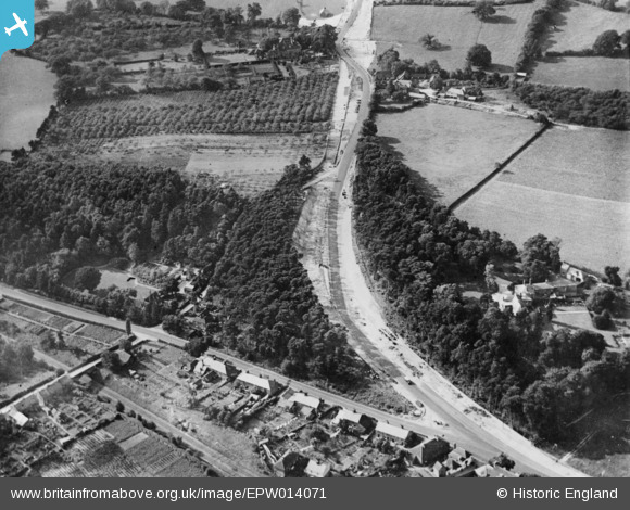
EPW014071 ENGLAND (1925). London Road, Wrotham Heath, 1925. This image has been produced from a copy-negative.
© Copyright OpenStreetMap contributors and licensed by the OpenStreetMap Foundation. 2026. Cartography is licensed as CC BY-SA.
Details
| Title | [EPW014071] London Road, Wrotham Heath, 1925. This image has been produced from a copy-negative. |
| Reference | EPW014071 |
| Date | August-1925 |
| Link | |
| Place name | WROTHAM HEATH |
| Parish | PLATT |
| District | |
| Country | ENGLAND |
| Easting / Northing | 563176, 158100 |
| Longitude / Latitude | 0.34084705689585, 51.29810112166 |
| National Grid Reference | TQ632581 |
