
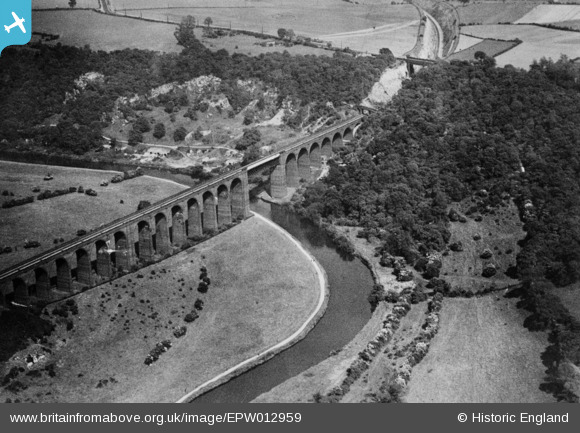
EPW012959 ENGLAND (1925). Conisbrough Viaduct, Conisbrough, 1925. This image has been produced from a copy-negative.
© Copyright OpenStreetMap contributors and licensed by the OpenStreetMap Foundation. 2026. Cartography is licensed as CC BY-SA.
Details
| Title | [EPW012959] Conisbrough Viaduct, Conisbrough, 1925. This image has been produced from a copy-negative. |
| Reference | EPW012959 |
| Date | June-1925 |
| Link | |
| Place name | CONISBROUGH |
| Parish | CONISBROUGH PARKS |
| District | |
| Country | ENGLAND |
| Easting / Northing | 452510, 399328 |
| Longitude / Latitude | -1.2085258599013, 53.48779055784 |
| National Grid Reference | SK525993 |
Pins
Be the first to add a comment to this image!