
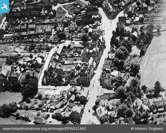
EPW011462 ENGLAND (1924). The High Street and New Road, Crowborough, 1924. This image has been produced from a copy-negative.
© Copyright OpenStreetMap contributors and licensed by the OpenStreetMap Foundation. 2026. Cartography is licensed as CC BY-SA.
Details
| Title | [EPW011462] The High Street and New Road, Crowborough, 1924. This image has been produced from a copy-negative. |
| Reference | EPW011462 |
| Date | July-1924 |
| Link | |
| Place name | CROWBOROUGH |
| Parish | CROWBOROUGH |
| District | |
| Country | ENGLAND |
| Easting / Northing | 551615, 131204 |
| Longitude / Latitude | 0.16378130724707, 51.059595740688 |
| National Grid Reference | TQ516312 |
Pins
 The Crowborough Cross - Formally the Red Cross Inn The Crowborough Cross - Formally the Red Cross Inn |

VCF |
Saturday 15th of August 2026 05:16:01 PM |