
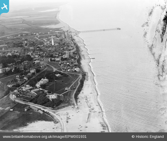
EPW001931 ENGLAND (1920). View of Southwold, the pier and lighthouse, Southwold, 1920
© Copyright OpenStreetMap contributors and licensed by the OpenStreetMap Foundation. 2026. Cartography is licensed as CC BY-SA.
Details
| Title | [EPW001931] View of Southwold, the pier and lighthouse, Southwold, 1920 |
| Reference | EPW001931 |
| Date | June-1920 |
| Link | |
| Place name | SOUTHWOLD |
| Parish | SOUTHWOLD |
| District | |
| Country | ENGLAND |
| Easting / Northing | 650905, 275857 |
| Longitude / Latitude | 1.6823594543288, 52.32295652721 |
| National Grid Reference | TM509759 |
Pins

SteveCBR |
Friday 17th of March 2023 01:33:16 PM | |

Alan McFaden |
Sunday 21st of July 2013 07:49:28 PM | |
|
Alan McFaden |
Sunday 21st of July 2013 07:48:38 PM | |
|
Alan McFaden |
Sunday 21st of July 2013 07:46:58 PM | |
|
Alan McFaden |
Sunday 21st of July 2013 07:45:25 PM | |
|
Alan McFaden |
Sunday 21st of July 2013 07:43:18 PM | |
|
Alan McFaden |
Sunday 21st of July 2013 07:41:46 PM | |
|
stodd |
Sunday 26th of August 2012 10:22:38 PM |


