
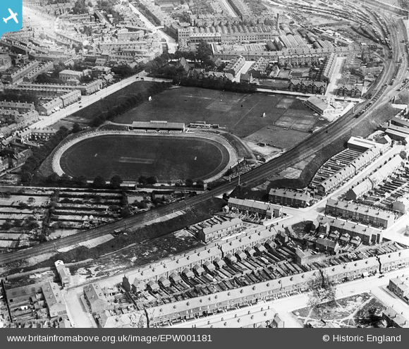
EPW001181 ENGLAND (1920). The Butts Sports Ground, Coventry, 1920
© Copyright OpenStreetMap contributors and licensed by the OpenStreetMap Foundation. 2026. Cartography is licensed as CC BY-SA.
Details
| Title | [EPW001181] The Butts Sports Ground, Coventry, 1920 |
| Reference | EPW001181 |
| Date | May-1920 |
| Link | |
| Place name | COVENTRY |
| Parish | |
| District | |
| Country | ENGLAND |
| Easting / Northing | 432292, 278757 |
| Longitude / Latitude | -1.525269841967, 52.405488954629 |
| National Grid Reference | SP323788 |
Pins

Robert |
Saturday 6th of August 2022 03:23:05 PM | |
|
JohnNis |
Sunday 24th of September 2017 09:19:52 PM | |
|
JG |
Friday 29th of August 2014 12:38:18 PM | |
In the early 1970s I saw a 'stunt' motoring display here with cars being driven round the track on 2 wheels. |
Coventry kid |
Tuesday 27th of December 2016 07:41:07 PM |
|
JG |
Thursday 28th of August 2014 04:31:40 PM | |
|
Derrickarthur |
Wednesday 26th of March 2014 08:37:26 PM | |
|
JG |
Wednesday 20th of February 2013 08:36:20 PM | |
|
JG |
Wednesday 20th of February 2013 08:32:16 PM | |
|
JG |
Wednesday 20th of February 2013 08:31:07 PM | |
|
JG |
Wednesday 20th of February 2013 08:29:32 PM | |
|
JG |
Wednesday 20th of February 2013 08:28:49 PM |