
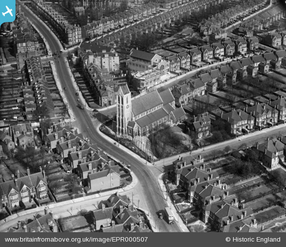
EPR000507 ENGLAND (1935). St Gabriel's Church and environs, Cricklewood, 1935
© Copyright OpenStreetMap contributors and licensed by the OpenStreetMap Foundation. 2025. Cartography is licensed as CC BY-SA.
Details
| Title | [EPR000507] St Gabriel's Church and environs, Cricklewood, 1935 |
| Reference | EPR000507 |
| Date | 1935 |
| Link | |
| Place name | CRICKLEWOOD |
| Parish | |
| District | |
| Country | ENGLAND |
| Easting / Northing | 523637, 185221 |
| Longitude / Latitude | -0.21655417328501, 51.551835042869 |
| National Grid Reference | TQ236852 |
Pins
 The Laird |
Wednesday 19th of September 2018 03:23:38 PM | |
Nowy Paul |
Saturday 27th of January 2018 04:29:17 PM | |
colsouth111 |
Tuesday 13th of January 2015 03:33:48 PM | |
colsouth111 |
Wednesday 12th of November 2014 09:00:56 PM | |
colsouth111 |
Wednesday 12th of November 2014 06:02:42 PM | |
colsouth111 |
Wednesday 12th of November 2014 06:01:57 PM | |
colsouth111 |
Wednesday 12th of November 2014 05:57:16 PM | |
colsouth111 |
Wednesday 12th of November 2014 05:55:31 PM | |
colsouth111 |
Wednesday 12th of November 2014 05:52:06 PM | |
colsouth111 |
Wednesday 12th of November 2014 05:51:06 PM |