
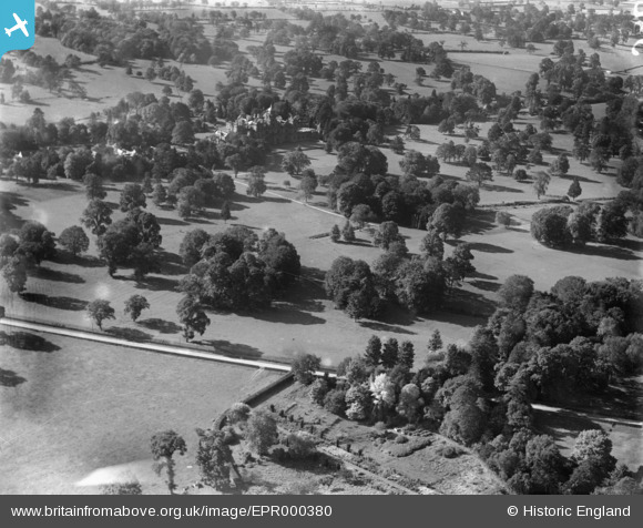
EPR000380 ENGLAND (1934). Westonbirt School and grounds, Westonbirt, 1934
© Copyright OpenStreetMap contributors and licensed by the OpenStreetMap Foundation. 2025. Cartography is licensed as CC BY-SA.
Details
| Title | [EPR000380] Westonbirt School and grounds, Westonbirt, 1934 |
| Reference | EPR000380 |
| Date | 28-September-1934 |
| Link | |
| Place name | WESTONBIRT |
| Parish | WESTONBIRT WITH LASBOROUGH |
| District | |
| Country | ENGLAND |
| Easting / Northing | 386541, 189959 |
| Longitude / Latitude | -2.1943758793927, 51.607833498446 |
| National Grid Reference | ST865900 |
Pins
Be the first to add a comment to this image!