
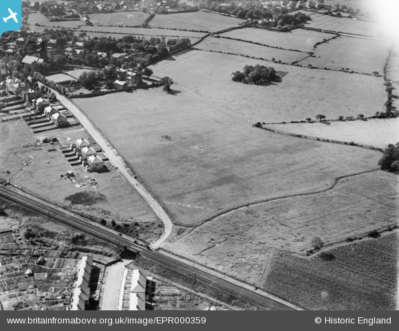
EPR000359 ENGLAND (1934). Huyton Hill Preparatory School Airfield, Huyton, 1934
© Copyright OpenStreetMap contributors and licensed by the OpenStreetMap Foundation. 2025. Cartography is licensed as CC BY-SA.
Details
| Title | [EPR000359] Huyton Hill Preparatory School Airfield, Huyton, 1934 |
| Reference | EPR000359 |
| Date | 25-September-1934 |
| Link | |
| Place name | HUYTON |
| Parish | |
| District | |
| Country | ENGLAND |
| Easting / Northing | 344904, 390922 |
| Longitude / Latitude | -2.8289755043813, 53.411967991005 |
| National Grid Reference | SJ449909 |
Pins

Pat |
Monday 27th of February 2023 06:36:32 PM | |
|
Pat |
Monday 27th of February 2023 06:36:08 PM | |
|
Pat |
Monday 27th of February 2023 06:35:20 PM | |
|
Pat |
Monday 27th of February 2023 06:34:55 PM | |
|
ata |
Monday 15th of August 2022 12:25:53 PM | |
|
ata |
Monday 15th of August 2022 12:25:24 PM | |
|
jimmyjoggers |
Monday 10th of November 2014 04:10:44 PM |