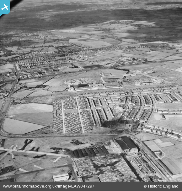
EAW047297 ENGLAND (1952). Housing off Speke Boulevard, Speke Industrial Estate and environs, Speke, from the south, 1952
© Copyright OpenStreetMap contributors and licensed by the OpenStreetMap Foundation. 2026. Cartography is licensed as CC BY-SA.
Details
| Title | [EAW047297] Housing off Speke Boulevard, Speke Industrial Estate and environs, Speke, from the south, 1952 |
| Reference | EAW047297 |
| Date | 4-October-1952 |
| Link | |
| Place name | SPEKE |
| Parish | |
| District | |
| Country | ENGLAND |
| Easting / Northing | 342801, 383371 |
| Longitude / Latitude | -2.8592460578745, 53.343871017814 |
| National Grid Reference | SJ428834 |
Pins

Matt Aldred edob.mattaldred.com |
Friday 8th of March 2024 04:56:51 PM | |

Matt Aldred edob.mattaldred.com |
Saturday 5th of February 2022 08:46:43 PM | |

Post-war prefabs |
Friday 25th of October 2019 12:54:03 PM | |
Not Belle Vale! Speke pre-fabs. |

Hamilton163 |
Sunday 28th of August 2022 11:21:36 AM |

Hamilton163 |
Sunday 15th of March 2015 05:51:53 PM | |

Hamilton163 |
Sunday 15th of March 2015 05:50:58 PM | |

Hamilton163 |
Sunday 15th of March 2015 05:48:48 PM | |

Hamilton163 |
Sunday 15th of March 2015 05:47:58 PM | |

Hamilton163 |
Sunday 15th of March 2015 05:45:04 PM | |

Hamilton163 |
Sunday 15th of March 2015 05:41:40 PM | |

Hamilton163 |
Sunday 15th of March 2015 05:40:52 PM | |

Hamilton163 |
Sunday 15th of March 2015 05:39:26 PM | |

Hamilton163 |
Sunday 15th of March 2015 05:38:10 PM | |

Hamilton163 |
Sunday 15th of March 2015 05:36:58 PM | |

Hamilton163 |
Sunday 15th of March 2015 05:35:58 PM | |

Hamilton163 |
Sunday 15th of March 2015 05:34:59 PM |

