
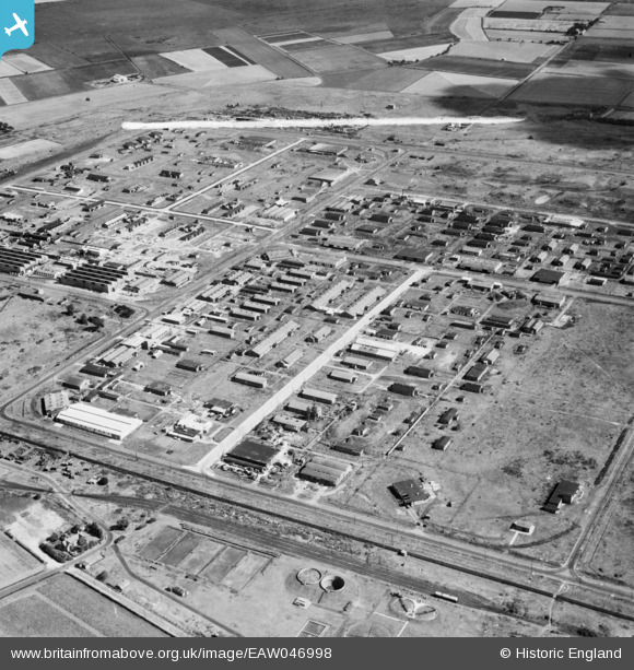
EAW046998 ENGLAND (1952). The Kirkby Industrial Estate around Newstet Road, Kirkby, 1952. This image was marked by Aerofilms Ltd for photo editing.
© Copyright OpenStreetMap contributors and licensed by the OpenStreetMap Foundation. 2026. Cartography is licensed as CC BY-SA.
Details
| Title | [EAW046998] The Kirkby Industrial Estate around Newstet Road, Kirkby, 1952. This image was marked by Aerofilms Ltd for photo editing. |
| Reference | EAW046998 |
| Date | 7-September-1952 |
| Link | |
| Place name | KIRKBY |
| Parish | |
| District | |
| Country | ENGLAND |
| Easting / Northing | 343163, 398990 |
| Longitude / Latitude | -2.8566253483747, 53.484302815011 |
| National Grid Reference | SJ432990 |
Pins
 PILLBOX: e43135 PILLBOX: e43135 |

Matt Aldred edob.mattaldred.com |
Wednesday 12th of August 2026 04:03:48 PM |