
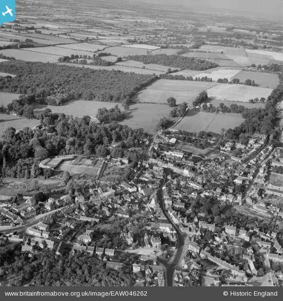
EAW046262 ENGLAND (1952). The town centre, Faringdon, from the south-west, 1952
© Copyright OpenStreetMap contributors and licensed by the OpenStreetMap Foundation. 2025. Cartography is licensed as CC BY-SA.
Details
| Title | [EAW046262] The town centre, Faringdon, from the south-west, 1952 |
| Reference | EAW046262 |
| Date | 25-August-1952 |
| Link | |
| Place name | FARINGDON |
| Parish | GREAT FARINGDON |
| District | |
| Country | ENGLAND |
| Easting / Northing | 428684, 195504 |
| Longitude / Latitude | -1.5852936412766, 51.657124591324 |
| National Grid Reference | SU287955 |
