
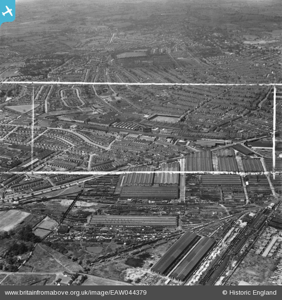
EAW044379 ENGLAND (1952). Derby Carriage and Railway Works and environs, Derby, from the east, 1952. This image was marked by Aerofilms Ltd for photo editing.
© Copyright OpenStreetMap contributors and licensed by the OpenStreetMap Foundation. 2026. Cartography is licensed as CC BY-SA.
Details
| Title | [EAW044379] Derby Carriage and Railway Works and environs, Derby, from the east, 1952. This image was marked by Aerofilms Ltd for photo editing. |
| Reference | EAW044379 |
| Date | 27-June-1952 |
| Link | |
| Place name | DERBY |
| Parish | |
| District | |
| Country | ENGLAND |
| Easting / Northing | 436749, 334147 |
| Longitude / Latitude | -1.4535760890871, 52.903182543073 |
| National Grid Reference | SK367341 |
Pins

redmist |
Saturday 22nd of June 2019 08:50:52 PM | |
|
redmist |
Saturday 22nd of June 2019 08:46:29 PM | |
|
redmist |
Saturday 22nd of June 2019 07:42:53 PM | |

Peter Kazmierczak |
Monday 21st of July 2014 10:55:30 PM | |
|
Triggy |
Wednesday 11th of June 2014 08:54:40 PM | |
|
Triggy |
Wednesday 11th of June 2014 08:53:40 PM | |
|
Peter Kazmierczak |
Saturday 7th of June 2014 09:06:15 PM |