
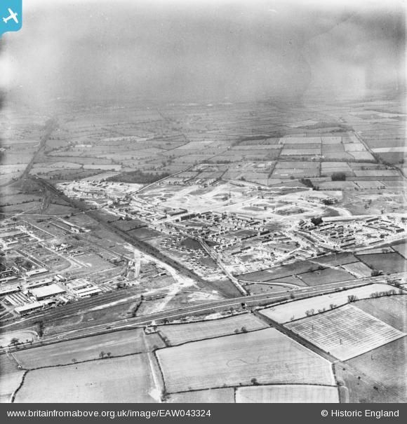
EAW043324 ENGLAND (1952). The town, Newton Aycliffe, from the south-east, 1952
© Copyright OpenStreetMap contributors and licensed by the OpenStreetMap Foundation. 2026. Cartography is licensed as CC BY-SA.
Details
| Title | [EAW043324] The town, Newton Aycliffe, from the south-east, 1952 |
| Reference | EAW043324 |
| Date | 16-May-1952 |
| Link | |
| Place name | NEWTON AYCLIFFE |
| Parish | GREAT AYCLIFFE |
| District | |
| Country | ENGLAND |
| Easting / Northing | 428575, 524050 |
| Longitude / Latitude | -1.5575253050463, 54.610683029035 |
| National Grid Reference | NZ286241 |
Pins

daver |
Wednesday 18th of April 2018 09:13:37 PM | |
|
Porcy |
Thursday 22nd of June 2017 12:19:28 PM | |
|
Porcy |
Thursday 22nd of June 2017 12:15:23 PM | |
|
Porcy |
Thursday 22nd of June 2017 12:03:44 PM | |
|
Porcy |
Thursday 22nd of June 2017 12:00:16 PM | |
|
Porcy |
Thursday 22nd of June 2017 11:59:06 AM | |
|
Porcy |
Thursday 22nd of June 2017 11:57:25 AM | |
|
Porcy |
Thursday 22nd of June 2017 11:56:03 AM | |
|
Porcy |
Thursday 22nd of June 2017 11:54:07 AM | |
|
Porcy |
Thursday 22nd of June 2017 11:51:46 AM | |
|
Chells809 |
Thursday 26th of June 2014 10:05:09 PM | |
|
Chells809 |
Thursday 26th of June 2014 10:01:47 PM |