
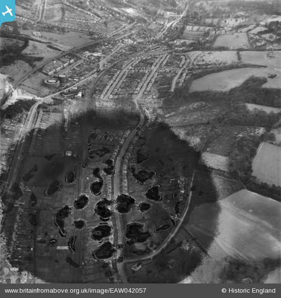
EAW042057 ENGLAND (1952). Housing off Valley Road and Beverley Road, Kenly, 1952. This image has been produced from a damaged negative.
© Copyright OpenStreetMap contributors and licensed by the OpenStreetMap Foundation. 2026. Cartography is licensed as CC BY-SA.
Details
| Title | [EAW042057] Housing off Valley Road and Beverley Road, Kenly, 1952. This image has been produced from a damaged negative. |
| Reference | EAW042057 |
| Date | March-1952 |
| Link | |
| Place name | KENLEY |
| Parish | |
| District | |
| Country | ENGLAND |
| Easting / Northing | 533224, 159287 |
| Longitude / Latitude | -0.088101458524286, 51.316568680715 |
| National Grid Reference | TQ332593 |
Pins

Gavin Thomas |
Saturday 12th of November 2022 05:55:59 PM | |
|
Tony74 |
Sunday 23rd of November 2014 10:17:54 PM | |
|
Tony74 |
Sunday 23rd of November 2014 10:12:15 PM | |
|
Tony74 |
Thursday 9th of October 2014 12:30:54 AM | |
|
Tony74 |
Thursday 9th of October 2014 12:30:20 AM | |
|
Tony74 |
Thursday 9th of October 2014 12:27:39 AM | |
|
Tony74 |
Thursday 9th of October 2014 12:21:36 AM | |
|
Tony74 |
Thursday 9th of October 2014 12:17:56 AM | |
|
Tony74 |
Thursday 9th of October 2014 12:16:23 AM | |
|
Tony74 |
Thursday 9th of October 2014 12:14:46 AM | |
|
Tony74 |
Thursday 9th of October 2014 12:13:15 AM | |
|
Tony74 |
Thursday 9th of October 2014 12:12:27 AM | |
|
Tony74 |
Thursday 9th of October 2014 12:10:59 AM | |
|
Tony74 |
Thursday 9th of October 2014 12:09:30 AM | |
|
Tony74 |
Thursday 9th of October 2014 12:08:46 AM | |
|
Tony74 |
Thursday 9th of October 2014 12:07:24 AM | |
|
Tony74 |
Thursday 9th of October 2014 12:05:29 AM |